
GaoFen-2

Download the Satellite Flyer-
- Satellite Introduction
- Image Gallery
GF-2 SATELLITE
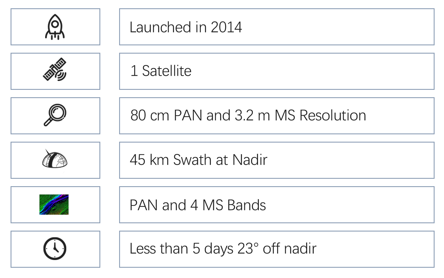
80 cm Resolution, 45 km Swath, Optical
GF-2(short for GaoFen-2) was launched on August 19, 2014. It is a very high-resolution optical imaging satellite with 80 cm panchromatic and 3.2 m multi-spectral resolution. It is equipped two identical cameras. The combined swath width of one pass at nadir is wider than 45 km. The imagery has been widely used for governmental services, marine monitoring, precision agriculture and forestry, emergency management, education and research.
Technical Specifications 
Mission life 8 years Weight 2100 kg Launch time August 19, 2014 Orbit Sun-synchronous, 10:30 am descending node, 631 km altitude Sensor bands Panchromatic, blue, green, red and near-infrared Resolution (at nadir) Panchromatic: 80 m, multi-spectral: 3.2 m Locational accuracy 50 m CE90 (w/o GCPs) Dynamic range at Imaging 10 bits Swath width (at nadir) 45 km Revisit capacity Less than 5 days 23° off nadir [Statement] These image samples are purpose for demonstration and non-commercial purposes by partners, clients, customers and users. Please be reminded of “SV/GF/ZY/HJ satellite imagery, SpaceWill's distribution” on the image in your use. Should you need any other images that are not released here, please connect us via marketing@spacewillinfo.com.
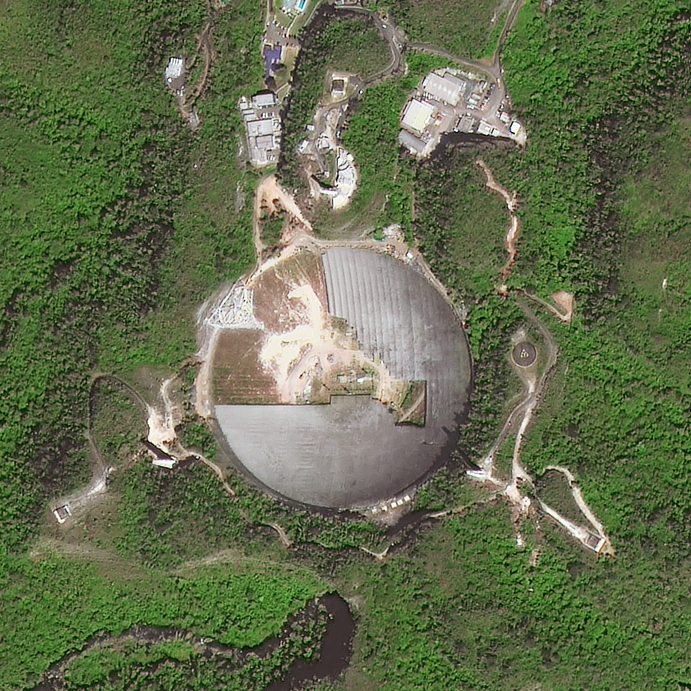 Cleanup of Arecibo Observatory Telescope, Puerto Rico
 Oil Pollution in Mediterranean Sea
 Horse-shaped Solar Power Plants in Inner Mongolia, China
 Beijing Daxing Int’l Airport, China
 HK-ZHUHAI-MACAO Bridge, China
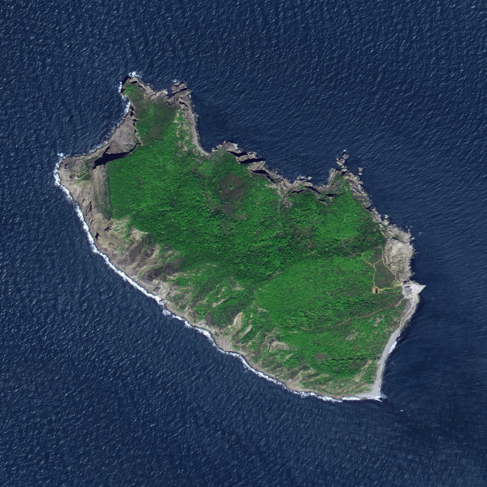 Dalian Vipers Island, Liaoning Province, China
 The Logo of the Expo Dubai, AUE