GaoFen-7


Download the Satellite Flyer-
- Satellite Introduction
- Image Gallery
GF-7 SATELLITE
65 cm, Bi-stereoscopic, Optical, Laser Altimeter
GF-7 (short for Gaofen-7) was launched on November 3, 2019. It is a very high-resolution optical imaging satellite, and collects bi-stereoscopic and panchromatic-multispectral imagery. It is also equipped one laser altimeter. The satellite collects overlap images and enables 1:10,000-scale stereoscopic mapping. Its laser altimeter provides great supports in mapping difficult geographic terrains. The satellite mainly applies in monitoring land resources, basic mapping, and investigating globally geographic features.
Technical Specifications 
Mission life 8 years Weight 2800 kg Launch time November. 3, 2019 Orbit Sun-synchronous, 10:30 am descending node, 506 km altitude Sensor bands Panchromatic, blue, green, red and near-infrared Resolution (at nadir) Panchromatic: 80 cm (front camera), 65 cm (rear camera);
multi-spectral: 2.6 m (rear camera)Locational accuracy 20 m CE90 (w/o GCPs) Dynamic range at imaging 11 bits Swath width (at nadir) 20 km (at nadir) Revisit capacity 5 days [Statement] These image samples are purpose for demonstration and non-commercial purposes by partners, clients, customers and users. Please be reminded of “SV/GF/ZY/HJ satellite imagery, SpaceWill's distribution” on the image in your use. Should you need any other images that are not released here, please connect us via marketing@spacewillinfo.com.
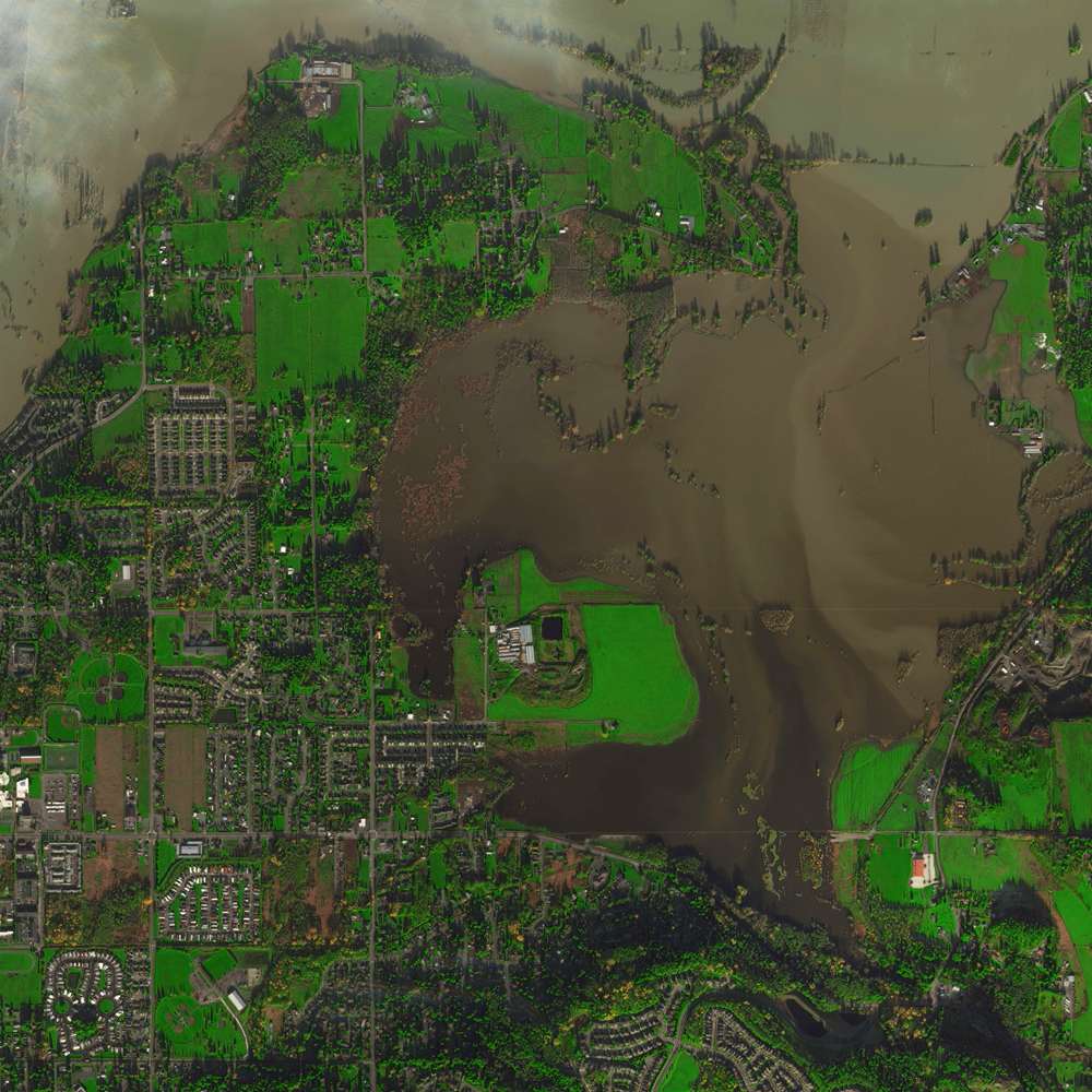 Extent of the Floods in Skagit River Park Sports Complex Playfields, Washington, USA
 Debris and Structural Damage Massively in Mayfield, Kentucky, USA
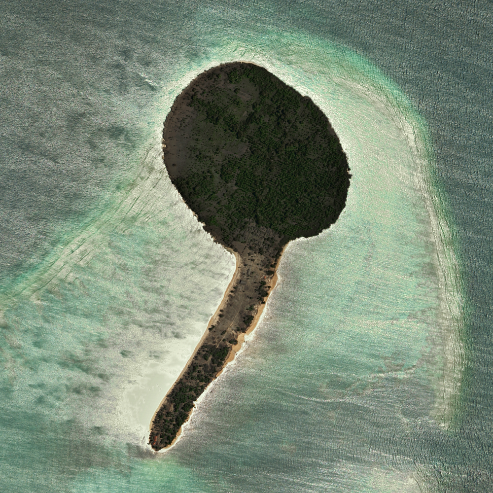 Atata Island, Tonga Buried by Volcanic Ash